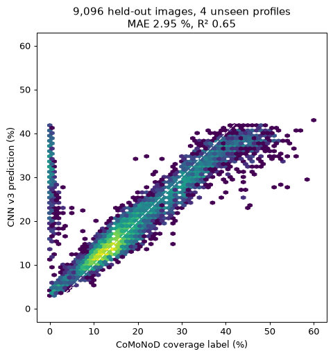
A convolutional network (ResNet-34, 1120-px images) trained to read nodule coverage (%) directly from seafloor photographs, using the GEOMAR SO268 OFOS corpus (Clarion-Clipperton Zone, 4,000–4,500 m; Purser et al. 2021 / Mbani & Greinert 2023, CC-BY) with per-image coverage labels from the CoMoNoD algorithm (Schoening 2021). Trained on the full corpus on a cloud GPU: 19,683 training images, tested on 9,096 images from four whole profiles the model never saw.
| Model | MAE (coverage %) | R² |
|---|---|---|
| CNN v3, best epoch (8) | 2.95% | 0.65 |
| Classical dark-blob thresholding (calibrated) | 3.4% | 0.53 |
| Predict the training mean | 10.3% | 0 |
| Profile | Area | Mean coverage | Images | MAE | R² |
|---|---|---|---|---|---|
| SO268/2_100-1 | German | 13% | 2,495 | 1.35% | 0.71 |
| SO268/2_128-1 | Belgian | 30% | 1,934 | 8.05% | 0.28 |
| SO268/2_147-1 | Belgian | 18% | 2,494 | 2.13% | 0.88 |
| SO268/2_177-1 | German | 13% | 2,173 | 1.18% | 0.82 |
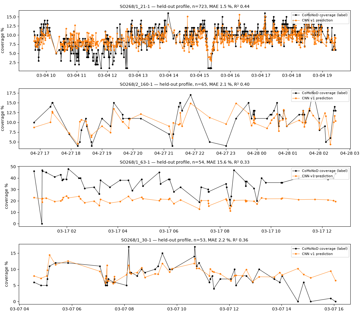
On sparse and medium fields the model reads coverage within one to two percentage points, image by image. The one packed profile (30% mean coverage) is the open problem: the class mean is right but per-image error is 8%. Part of that is label noise — the labelling algorithm itself is least reliable in packed facies — and it is the same failure mode TMC reported for its 2018 tooling.
| Epoch | Holdout MAE | R² |
|---|---|---|
| 1 | 5.74% | 0.43 |
| 2 | 5.57% | 0.25 |
| 3 | 4.23% | 0.58 |
| 4 | 4.49% | 0.59 |
| 5 | 3.62% | 0.31 |
| 6 | 2.96% | 0.63 |
| 7 | 3.91% | 0.35 |
| 8 | 2.95% | 0.65 |
| 9 | 3.00% | 0.61 |
| 10 | 2.99% | 0.59 |
| 11 | 3.16% | 0.60 |
| 12 | 2.99% | 0.61 |
Coverage from imagery is the dense, cheap signal; box cores are the sparse, expensive truth. A detector like this turns every AUV or towed-camera transect into a continuous coverage map, which is the input to a CRIRSCO/ISA Annex V-style abundance block model once co-located core photos calibrate coverage to kg/m². Our first calibration test on the 36 SO268 box cores showed that track-average coverage alone does not predict core abundance — the kg/m² step needs per-core scaled photos and burial covariates.
Draft, 2026-09-21 — Bryce Judy. Images and labels © their authors under CC-BY 4.0; model outputs are ours. Atlas.