Loading…
Dataset viewer and quality inspector for the Test-3.2K evaluation set
UAV-MapVQA
Evaluating Foundation Models on Instance-to-Entity Grounding Question Answering across UAV Imagery and Vector Maps
Can a foundation model ground a drone-observed visual instance to its exact real-world entity in a vector map, and reason using map knowledge? Every multiple-choice question pairs a real UAV image with the OpenStreetMap map of the same area, and answering it means matching entities across the two views.
8 tasks at 4 levels
400 questions per task
Visual version, north-up OSM raster
VETRA, UAV-VisLoc, AirLock, USGS-RSCC
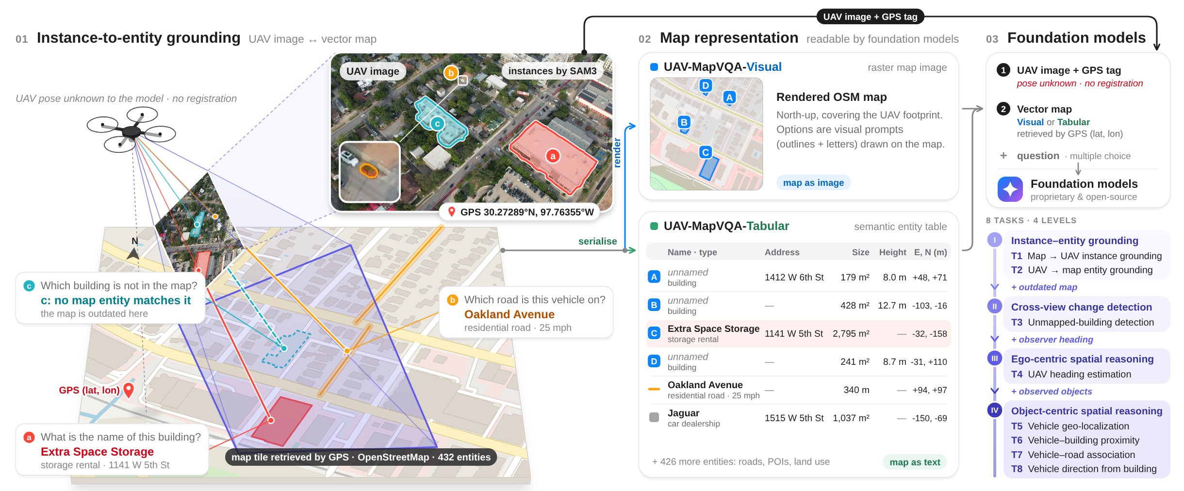
Swipe sideways to see the whole figure, or tap it to open full size.
Four levels, eight tasks
Each level adds one capability to the one before it.
Loading questions…
Where the data comes from
Questions are read from all_400.jsonl (400 per task): osm_building_corr/vqa holds T1–T3 and
osm_object_context/vqa holds T4–T8, next to their images and debug panels. Your ratings stay in this browser until you export them.
To run the viewer locally from the dataset repository: cd ICLR2027-UAV-Dataset && python -m http.server 8000, then open
http://localhost:8000/inspect_vqa/inspector.html (add ?file=all.jsonl for the full 500-per-task build).
Build a review set
Choose the tasks and how many questions to review from each.
Tasks
Review status
Questions per task drawn at random from each selected task
0100200300400