How cattle ranches are chewing up the Amazon rainforest
For about three years now, we’ve been working on curbing the impacts of the soya industry on the Amazon rainforest in Brazil which, before the current moratorium was put into place, was replacing the forest with plantations on a massive scale.
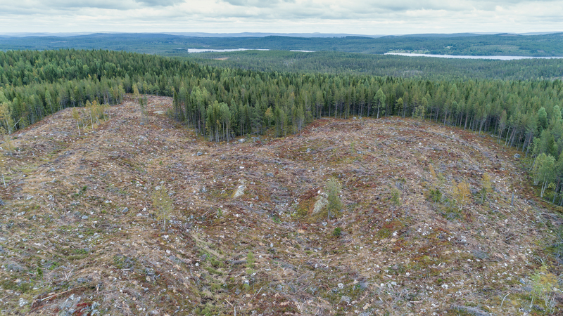
However, there’s another agricultural sector cutting deep into the forest which we’re also going to tackle: cattle ranching. To assess the scale of the problem, Greenpeace researchers in Brazil have produced a new set of maps showing how the Amazon region has suffered.
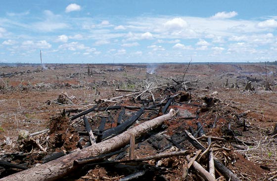
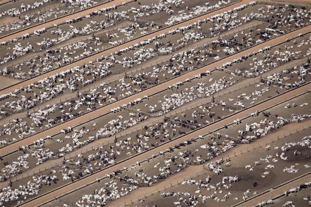
Cattle ranching is now the biggest cause of deforestation in the Amazon, and nearly 80 per cent of deforested areas in Brazil are now used for pasture. The cattle industry has ballooned since the 1970s, giving Brazil the largest commercial cattle herd in the world. Since 2003, the country has also topped the world’s beef export charts and the government plans to double its share of the market by 2018.
The impact this is having on the forest is huge – between 1996 and 2006, an area the size of Portugal was carved out for cattle ranching. As with the soya industry, a host of social ills have followed the wave of expansion. Cattle ranching has the highest rates of slave labour in Brazil – just over 3,000 people held as slaves were freed from ranches last year.
You can read more about the maps and how they were created in the full report (pdf). There’s also a Google Earth file (8mb) showing details from the maps.
Now, with the Brazilian government pushing for the industry to expand on such a massive scale, it throws their targets announced last month for reducing deforestation into serious doubt. It also poses a significant threat to efforts to combat climate change. Deforestation is largely responsible for making Brazil the fourth largest greenhouse gas emitter, and the cattle industry also contributes a significant quantity of emissions in the form of bovine methane emissions (or cow farts if you want to be less tactful).
The new cattle footprint maps our Brazilian team have produced focus on Mato Grosso, a state which has the largest cattle herd in Brazil and seen large areas of forest lost in favour of pasture, and an innovative process has been used to analyse satellite imagery. The new technique uses images from the Moderate Resolution Imaging Spectroradiometer (Modis) satellite to identify whether land is being used for crops or pasture, or if it’s still covered in trees.
By comparing the spread of cattle ranching with other data – such as the locations of industrial-sized slaughterhouses, roads and other infrastructure elements – they’ve built a picture of how the livestock industry is affecting the region.
For instance, the maps show a marked concentration of deforested areas and pasture around the slaughterhouses. They also demonstrate how roads have opened up new areas of the forest to agriculture, including unofficial roads which don’t feature on government charts.
We can now use these maps to show how the use of land has changed from forest canopy to crops and pasture, as well as highlighting the clear link between cattle ranching and deforestation in the Amazon. This information is going to be vitally important as our campaign on cattle ranching develops, which will be pushing the Brazilian government to get a grip on the industry and stop deforestation in the Amazon. On a global scale, it will also help our work to get other countries like the UK to provide funds in support of efforts to stop deforestation around the world.